SEPTA NORRISTOWN LIDAR MAPPING
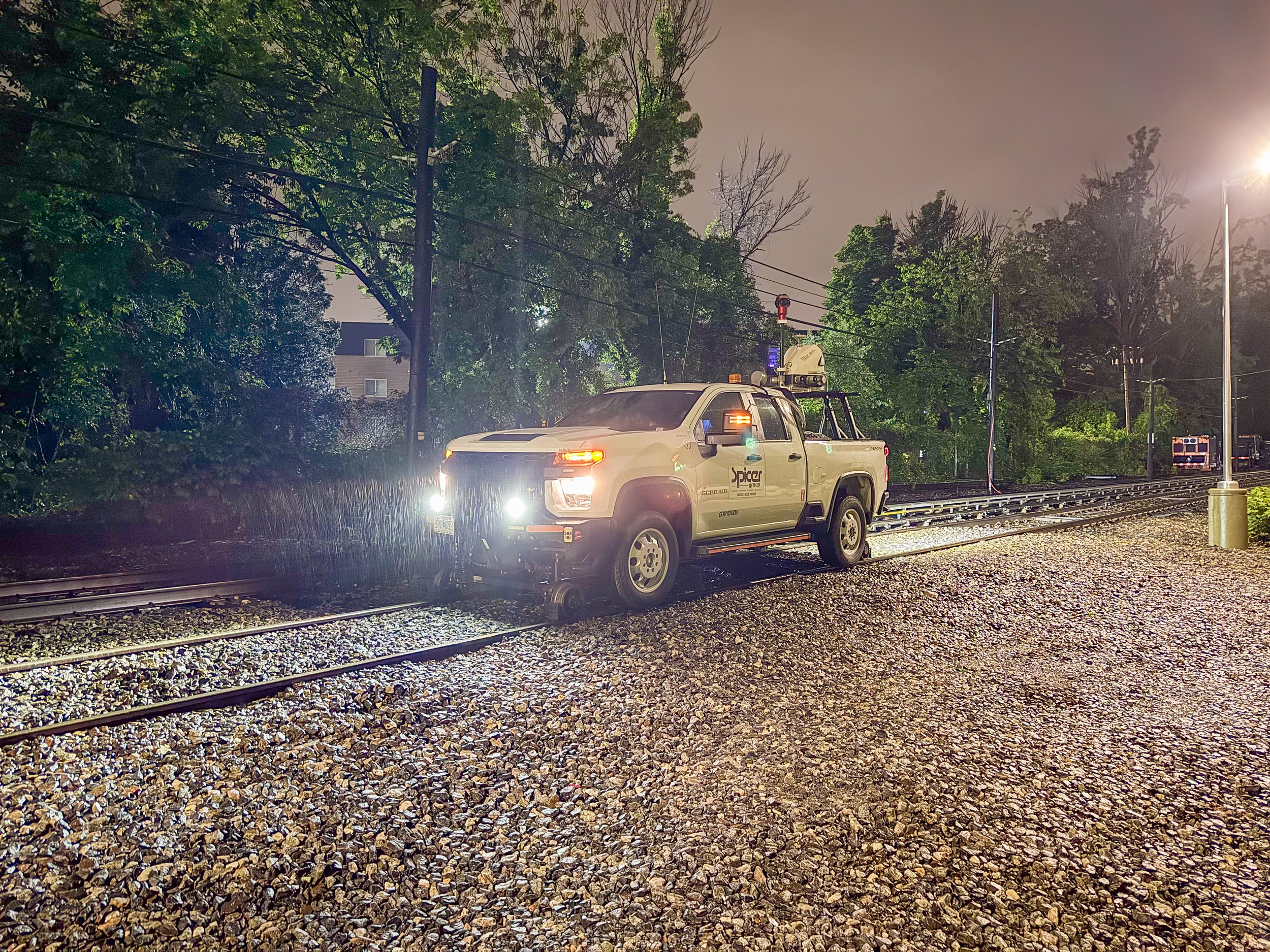
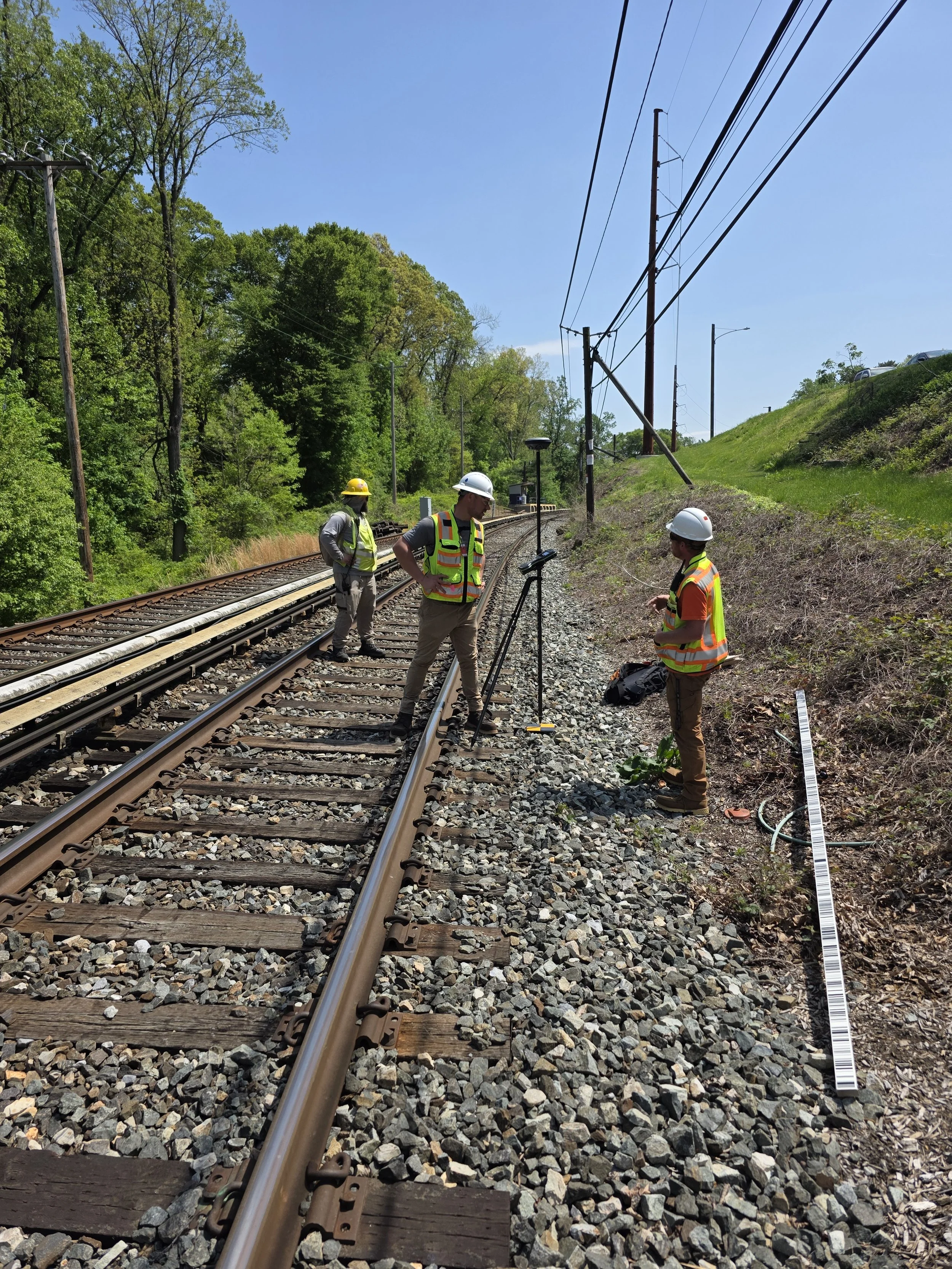
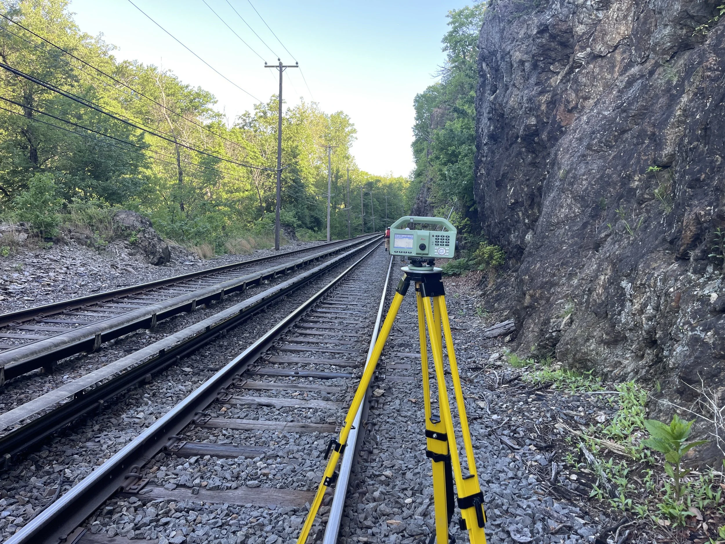
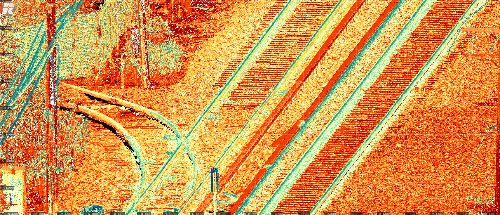
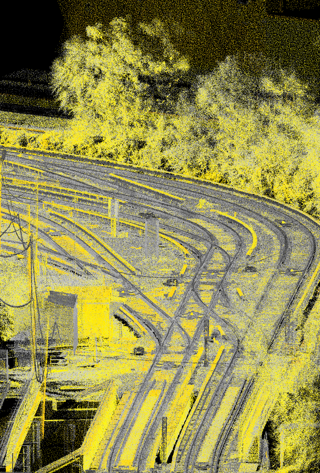
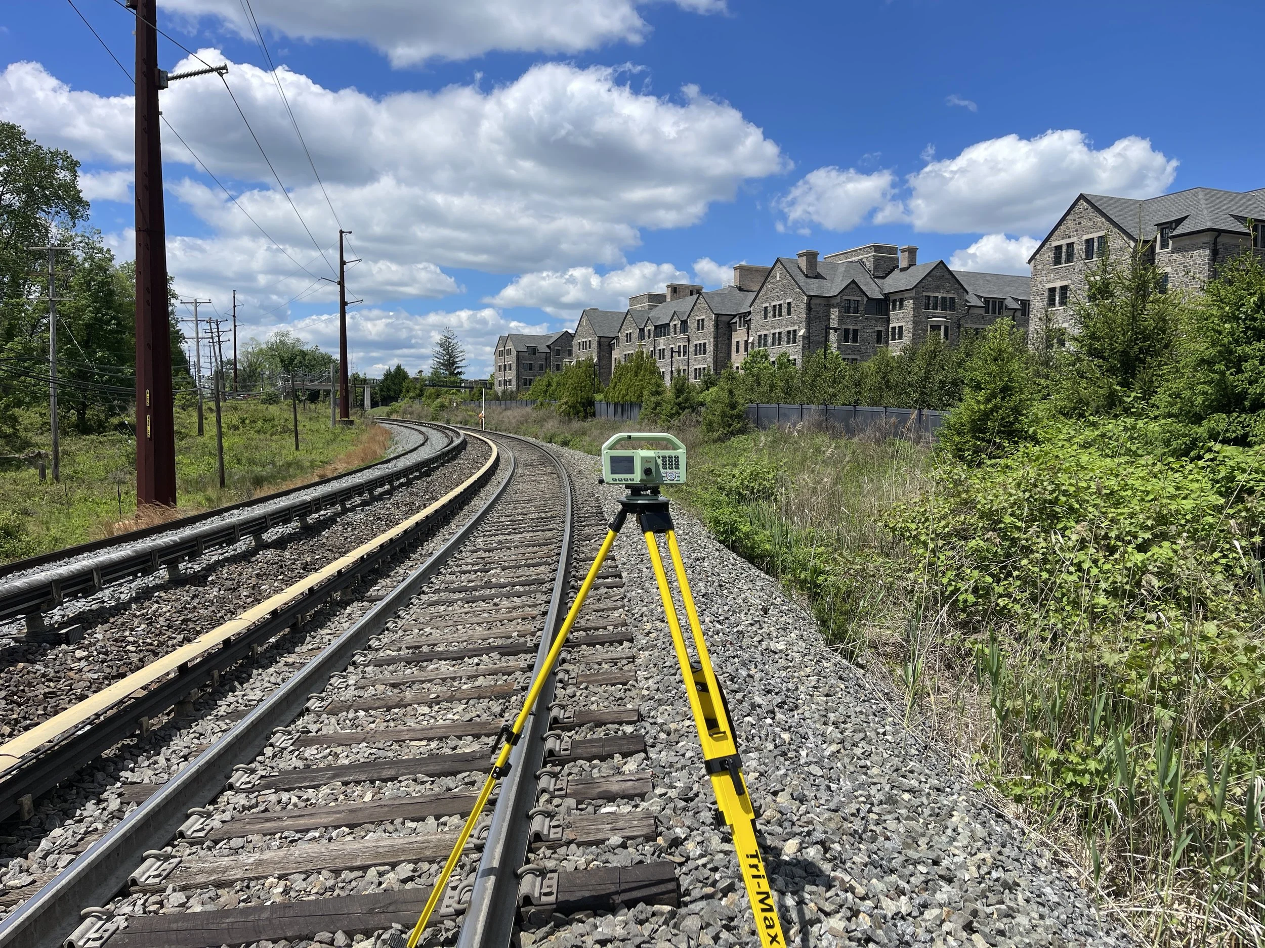
Spicer Group provided full surveying and geospatial support for a design-level topographic survey of approximately 13.5 miles of the SEPTA Norristown High Speed Line (NHSL), the train system near Philadelphia, PA, extending from the Norristown Transportation Center to the 69th Street North Terminal Center. Mobile LiDAR was deployed using a hi-rail-equipped vehicle, with all data collected during the nighttime. The vehicle was retrofitted with supplemental lighting to allow spherical imaging capture, ensuring complete feature visibility for extraction and design use. A high-accuracy 3D control network supported the LiDAR acquisition, with primary control established by SAS Geospatial and Spicer Group responsible for the intermediate control work. This included the installation of 65 new control points and 207 mobile scan targets, supplemented by ties to existing monuments from prior King of Prussia and 69th Street projects to maintain network consistency.
Intermediate control points were placed about every 1,000 feet, and LiDAR targets were set roughly every 600 feet to guide the mapping work. After collecting the data, Spicer Group processed the LiDAR scans to build a detailed 3D model of the entire rail corridor. The team mapped all key track features including the rails, centerlines, guard rails, third rail, and all switch and crossing components and organized them clearly in the project drawings. This accurate digital map gives SEPTA a dependable base for future design work, maintenance planning, and construction along the NHSL.
PROJECT PHOTOS