Ingham County Wayfinding
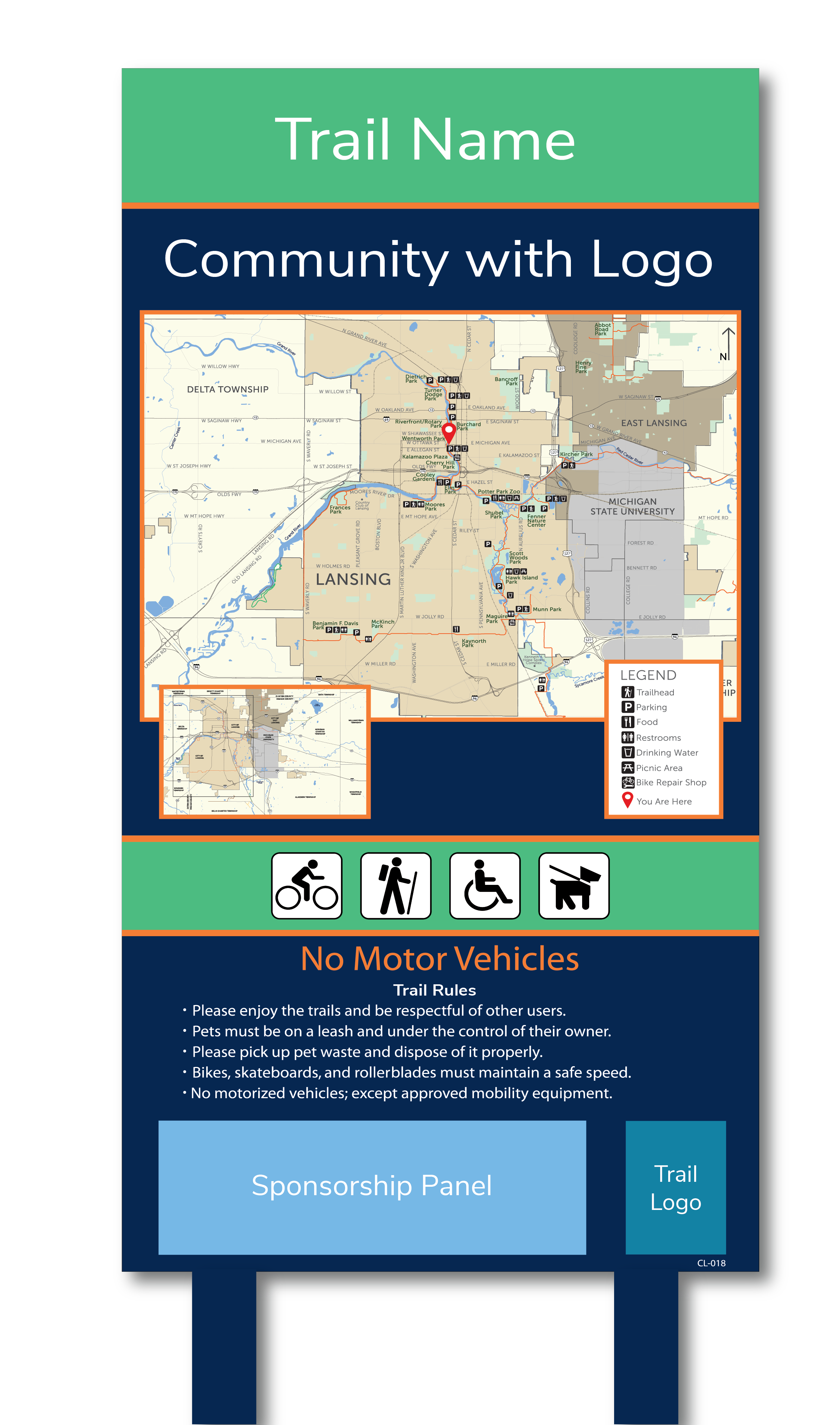
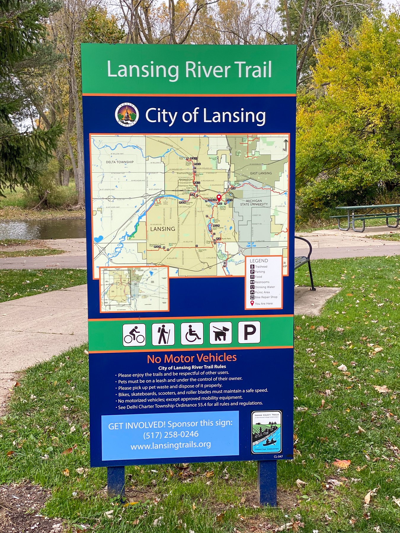
Near the banks of the Red Cedar River, a brand new bright blue wayfinding sign with bold white letters spelling out “Krueger’s Landing” stands tall. This trailhead sign displays a map, rules, and amenities available on the Lansing River Trail, which runs through Krueger’s Landing Park.
This sign, along with more than 300 others, were recently installed on trails throughout communities within Ingham County as part of the first phase of the Ingham County Parks Trail Wayfinding System project.
Ingham County is home to multiple parks and trail systems that are operated not just by the county, but by other municipalities within the county. Paved and unpaved trail routes circulate along the rivers, roads, and through natural areas around the communities, offering recreation and alternative transportation opportunities to residents. In 2016, voters approved a millage that supports the development of a county-wide regional trails and parks system. The millage was renewed in 2020 and raises an estimated $4 million per year.
In 2017, Spicer Group was hired by Ingham County Parks to provide professional planning and consulting assistance for the county’s trails and parks system. Part of that job included developing a comprehensive wayfinding plan for trails within the county.
Tim Morgan, the Parks and Recreation Director for Ingham County, said wayfinding and signage was identified as a high priority throughout the regional trail system. Tanya Moore, PLA, the project manager for Spicer Group, said the reason a trail wayfinding system is necessary is to make it easier for users to navigate and have a sense of place along the trails.
“Imagine yourself on a highway in Michigan, without having any signs and trying to figure out where you are and where you need to go,” Moore said. “A trail without a wayfinding system is kind of the same thing.”
Working with Ingham County and stakeholders from invested communities, organizations, and individuals around the county, Spicer Group gathered input through a series of meetings where discussions centered on what the wayfinding system’s mission was, what information to include in the system, and how that information would look and be displayed on the signage. After nearly a year of these discussions, with that input in hand, Moore said a plan was developed and approved.

Each community within Ingham County was given the chance to participate in the first phase of the trail wayfinding project. Along with the county, the other communities that chose to participate were Aurelius Township, the City of East Lansing, the City of Lansing, the City of Leslie, Delhi Township, and Meridian Township.
These communities did an initial evaluation to determine the total number of signs they would need, and that number totaled more than 300 signs.

“We were excited in the participation level of the first phase,” Nicole Wallace, the Ingham County Trails and Parks Millage Coordinator, said. “We have already had four new communities express interest in participating in the next phase, and we would anticipate even more involvement with other communities as we move along.”
The communities were responsible for deciding which types of signs they needed for their trails, where those signs would be located, and provide the information to be displayed on the signs. Spicer Group and Ingham County worked with each of these communities to ensure consistent information would be received. A form and instructions were developed, and each community was responsible for providing their sign information on these forms. Spicer Group collected, deciphered, and compiled all this information.
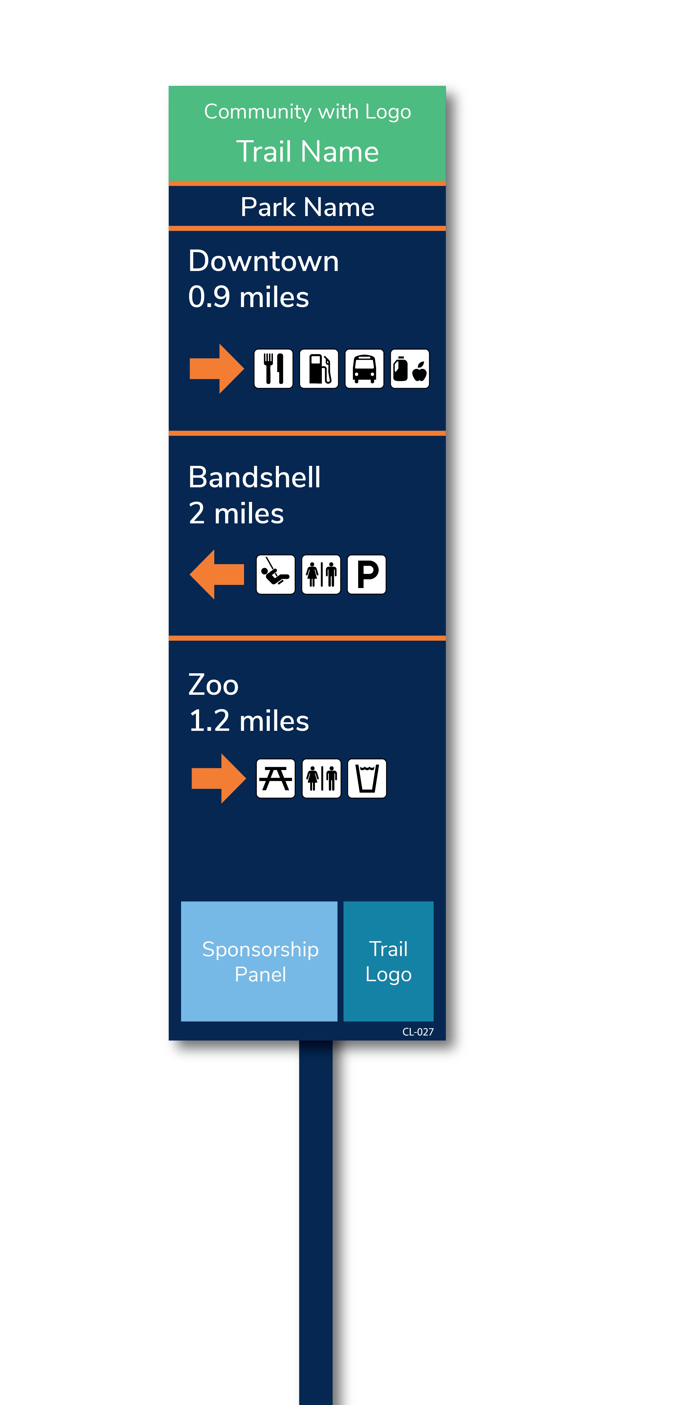
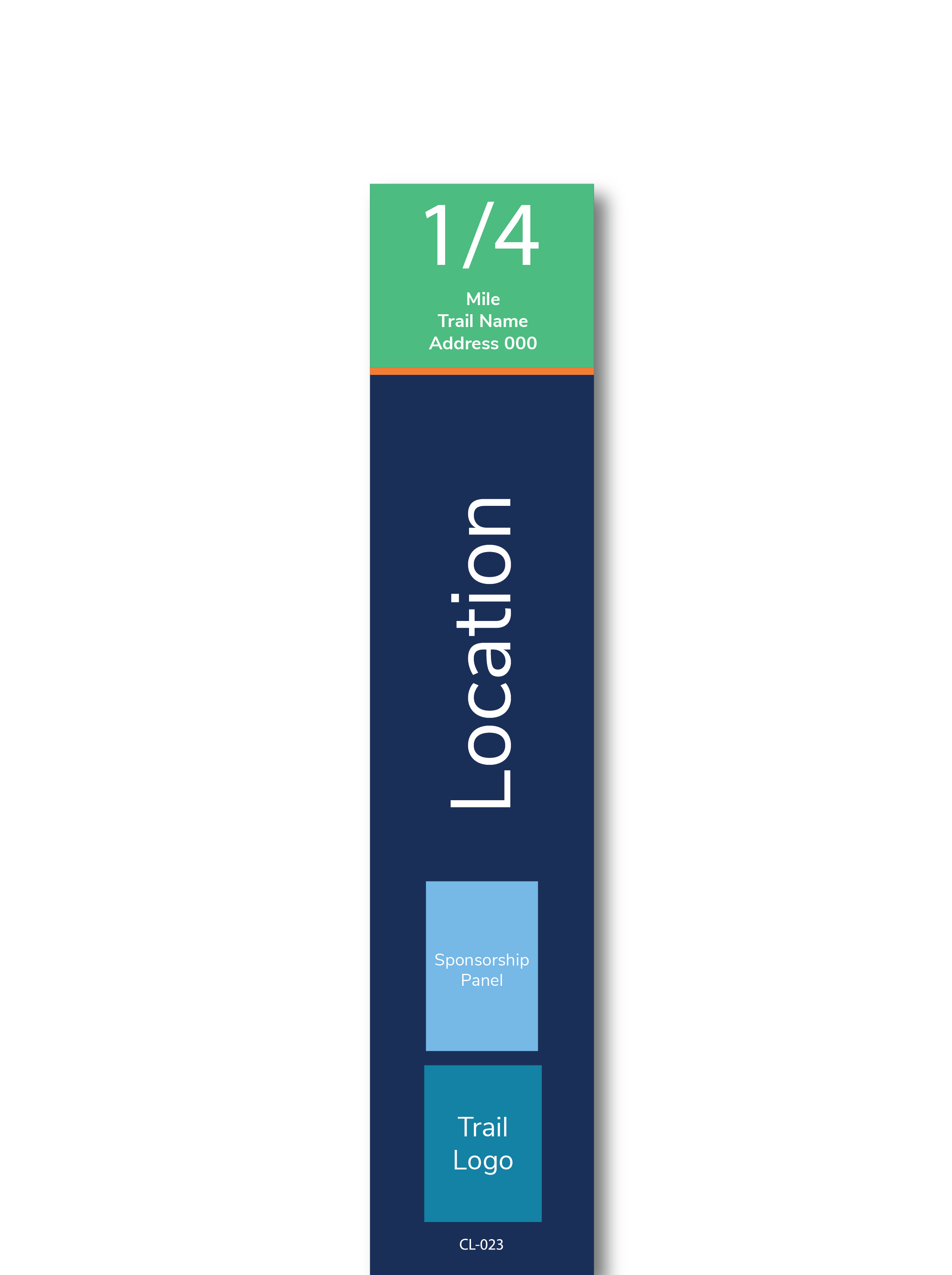
“There are three main types of signs used within the system,” Moore said. “A trailhead sign, is a bigger sign with a map and rules; a trailblade, is a directional type of sign, showing which way points of interest are located; and a mile marker, showing the length traveled along the trail.”
A fourth type of sign, an on-road sign, was used in Aurelius Township to connect to other community’s trail systems and parks.
While each different type of sign – trailhead, trailblade, and mile marker – has similar colors and layouts used for the entire system, each sign has different information. Once all the information was collected, there were over 300 different signs for the project.
“The unique thing about this system is the sheer size of it,” Moore said. “This first phase was over 300 signs. It was massive. It was not just an elephant; it was a herd of elephants.”
Another interesting item included on this project is tying it into Ingham County’s 911 GIS system. Each mile marker along the trails is given a unique address number. This not only allows a trail user to measure their distance traveled, but also gives better location information for a user in need of emergency services.
Moore and the team at Spicer Group, along with the county and each community, verified the information on each sign before placing that information within the approved design for that sign type, even using GIS to develop the maps to be displayed on the signs. Morgan said that Spicer Group was diligent about the details.
“That is a must when developing nearly 300 individual signs throughout the wayfinding system in phase one,” Morgan said.
Signs were constructed and installed throughout the spring and summer of 2020. Wallace said the feedback from trail users and the stakeholders involved has “been nothing but positive.”
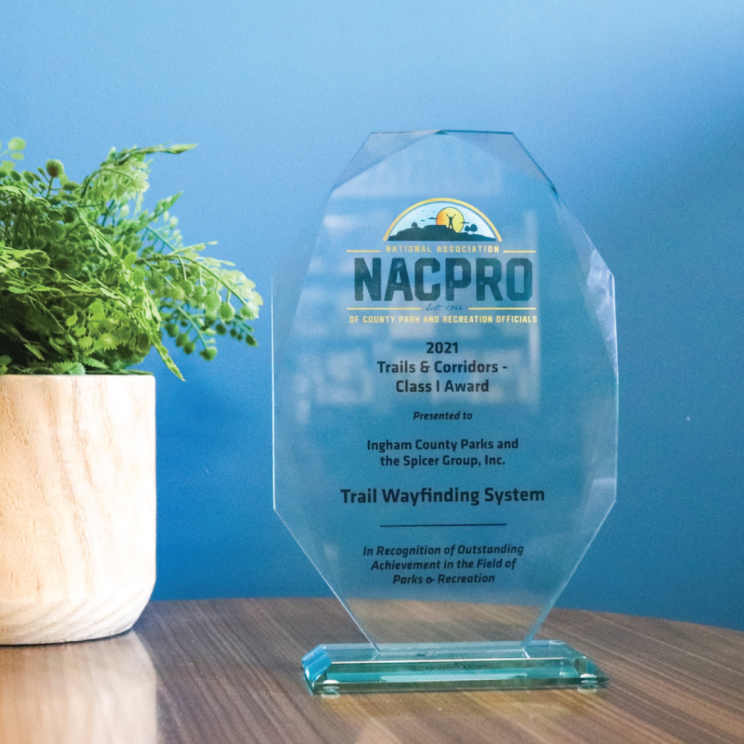
In August of 2021, Ingham County Parks and Spicer Group were selected to receive a 2021 National Association of County Park and Recreation Officials (NACPRO) Trails & Corridors Class I Award for the Trail Wayfinding System.
“It is nice to be recognized nationally by peers with all the hard work that was put into it by our local entities, our staff at the Ingham County Parks, and Spicer Group,” Morgan said.