South County Water Asset Mapping
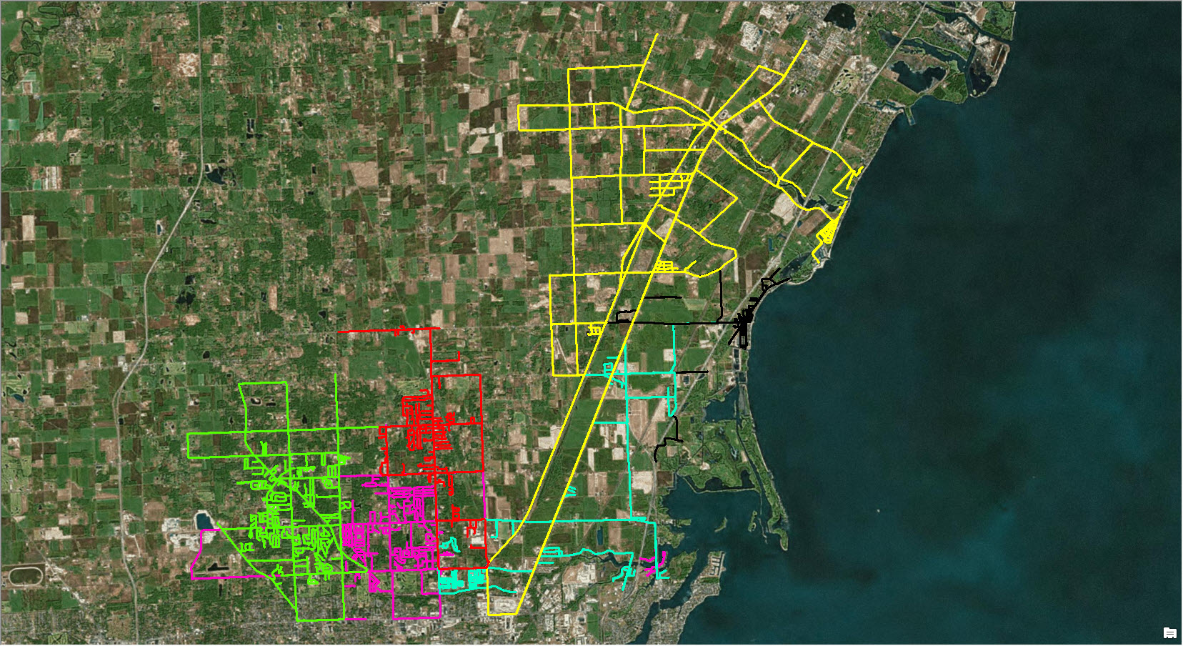
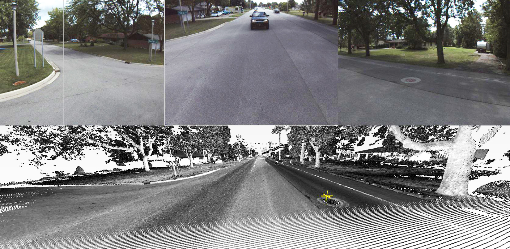
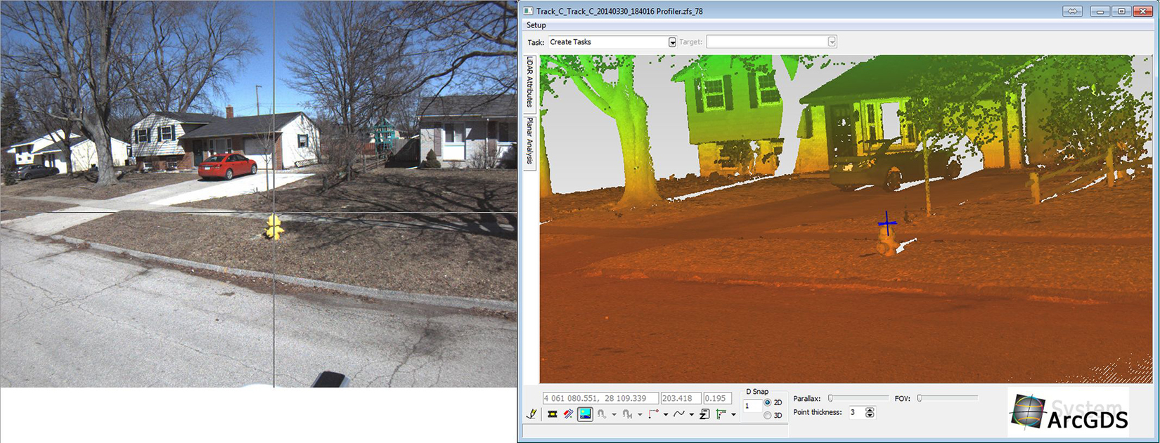
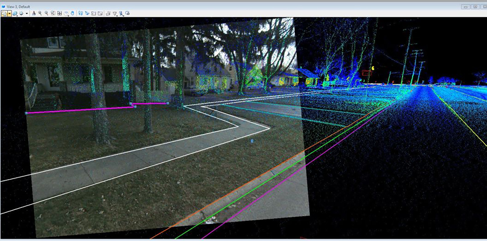
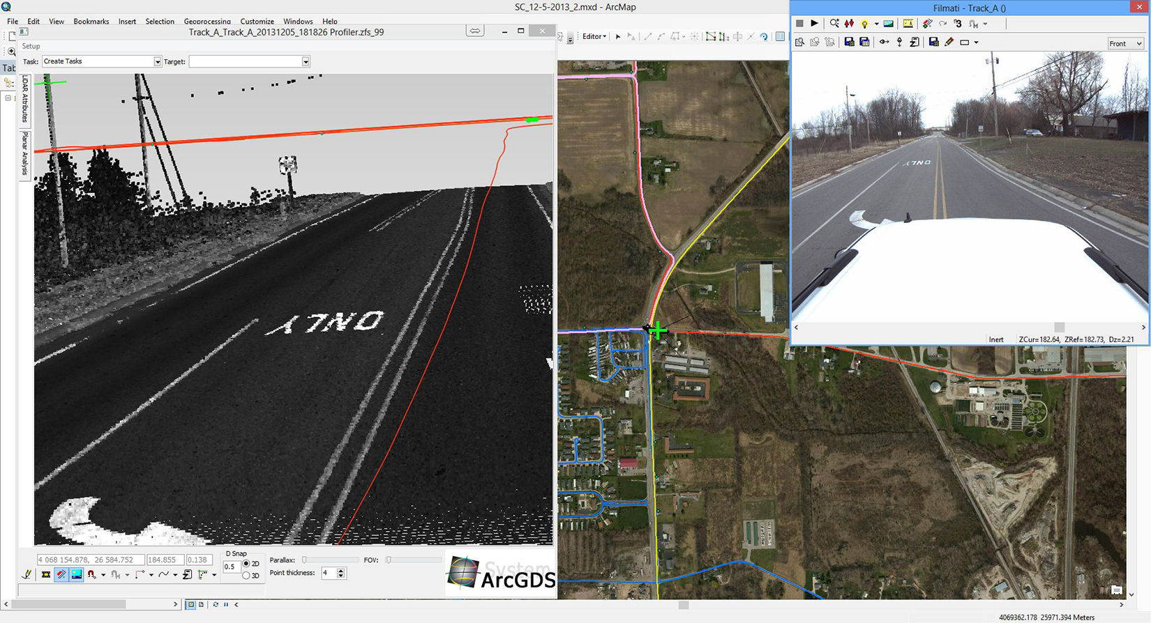
Spicer Group was selected by the Authority to develop an accurate electronic base map of all water infrastructure assets within the entire water district boundaries. Rather than commence a “boots-on-the-ground” effort to physically survey over 4,000 assets, mobile mapping technology was selected as the most efficient method of collecting precise XYZ positions of the desired assets. Spicer’s mobile mapping team collected survey-grade Mobile LiDAR and imagery data on the entire right-of-way under the Authority’s jurisdiction. Precise XYZ positions of the water infrastructure assets were then extracted from the LiDAR dataset with appropriate attribute data recorded, and an ArcGIS geodatabase was populated to support the initial base mapping efforts.
360-degree coverage of data along 400 miles of roadway allowed the Authority to share LiDAR data with other agencies. For example, data was provided in the free viewer to the fire department for instant access of hydrant locations in emergency situations.
KEY DELIVERABLES
Survey-grade positions (XYZ) of all water feature assets
ESRI ArcGIS geodatabase containing base mapping for the entire water district
Survey-grade LiDAR data collected on the entire right-of-way to support future engineering efforts
Standard topographic survey drawings can be prepared to support future engineering projects with minimal field effort
Client benefited from working with an ESRI Silver Tier Business Partner