Saginaw-Midland Municipal Water Supply Corporation Information Management System
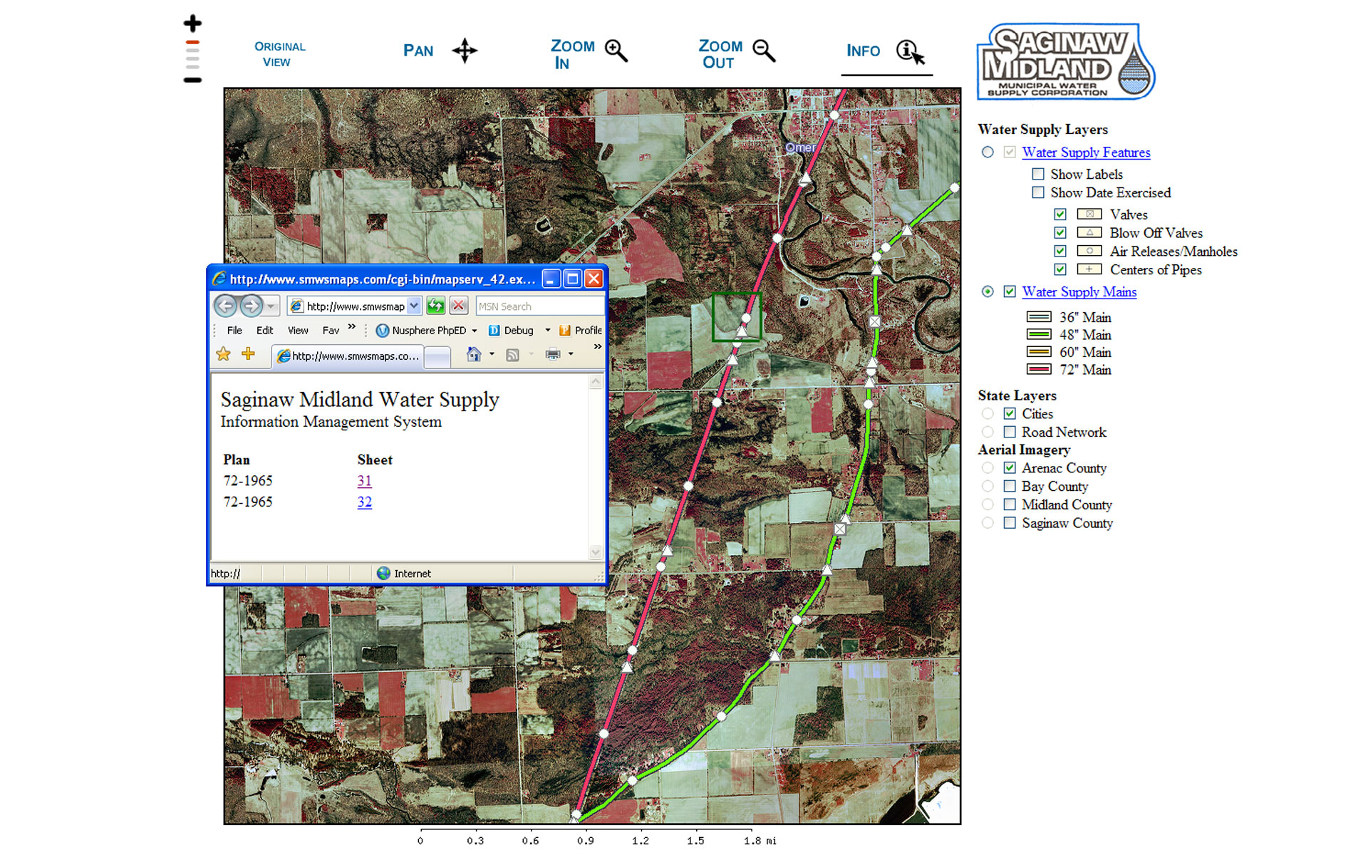
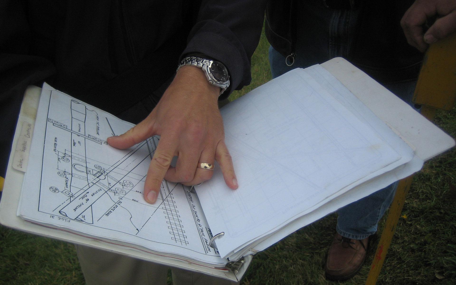
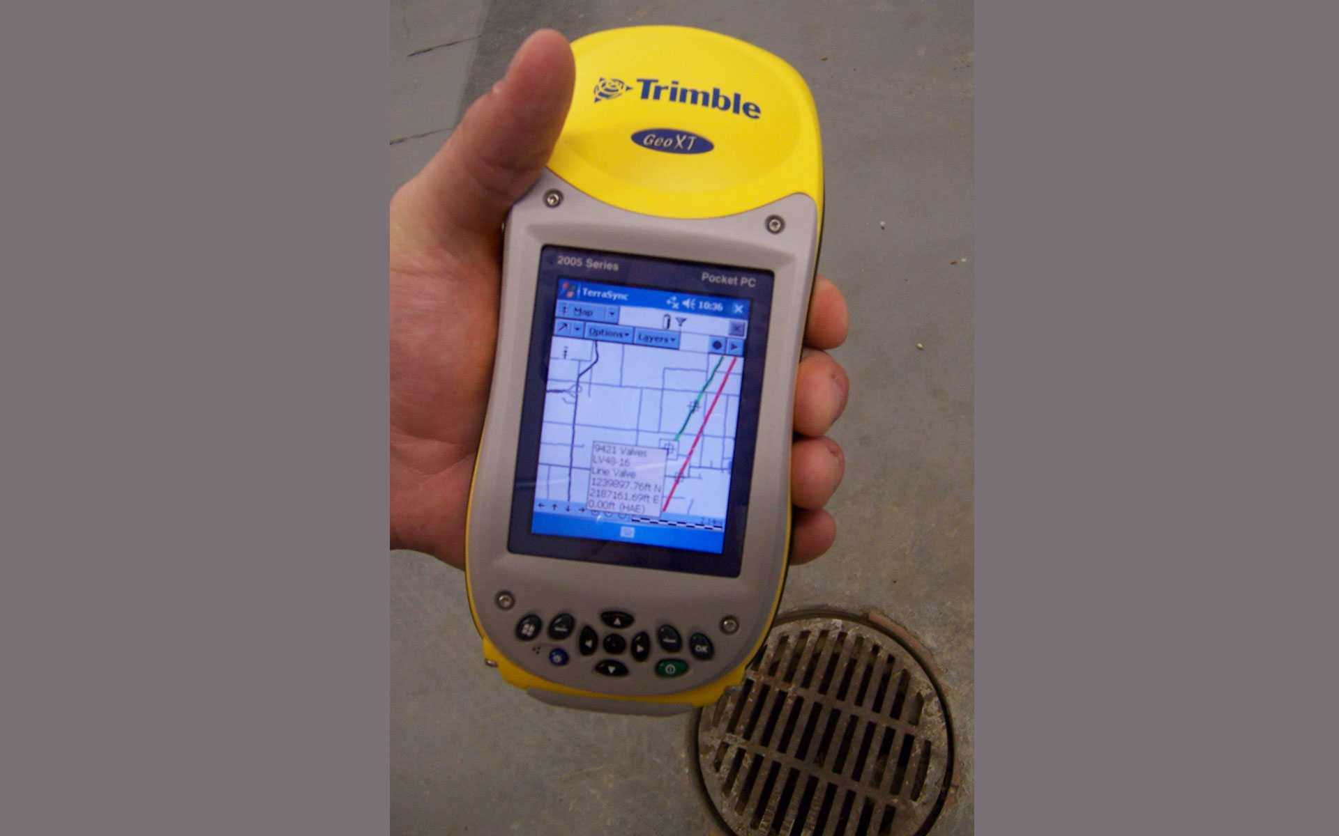
SMMWSC is the owner and operator of a 100-mile-long pipeline system that conveys raw water from Lake Huron to water treatment plants in the cities of Midland and Saginaw. Those plants in turn supply treated water to nearly 250,000 customers. The pipeline, which begins nearly two miles offshore in Lake Huron, has the capacity to pump 115 million gallons a day. There are 224 mechanical components located throughout the length of the pipeline. Each component serves a specific purpose. Because SMMWSC managers and staff had no real efficient means of searching through old archives, records, and performing maintenance measures on the pipeline, Spicer surveyed the entire length of the pipeline system and located 224 different pipeline features which were recorded using Global Positioning System (GPS) technology. Details for each feature such as valve make, operating status, and maintenance history were also cataloged. Over 350 original as-built drawings were digitally scanned. All of the information was downloaded and incorporated into a GIS system that allows users to view the complete pipeline system on a computer. SMMWSC staff can now simply punch in coordinates of a particular pipeline feature into their GPS units and follow the given course to within three feet of its location. Drawings, maintenance records, and field notes can also be accessed through the network. This new system will ensure the security and reliability of its extensive pipeline system and preserve the knowledge of its veteran maintenance crew.
Major benefits of the new information management system include:
Crews can access digitized drawing from GIS-equipped computers at multiple locations, including a laptop while out in the field.
Maintenance activities can be added for all mechanical components along the pipeline.
Maintenance notes can be electronically added to drawings of the pipeline.
Digital archives of drawings and records are stored off-site as part of a disaster preparedness program.
Current and future staff can locate pipeline features in spite of weather conditions, difficult-to-reach locations, and lack of knowledge or experience of the system.