Shoring Up the Riverbank
Spicer Group’s Role in the Ojibway Island Bank Stabilization Project
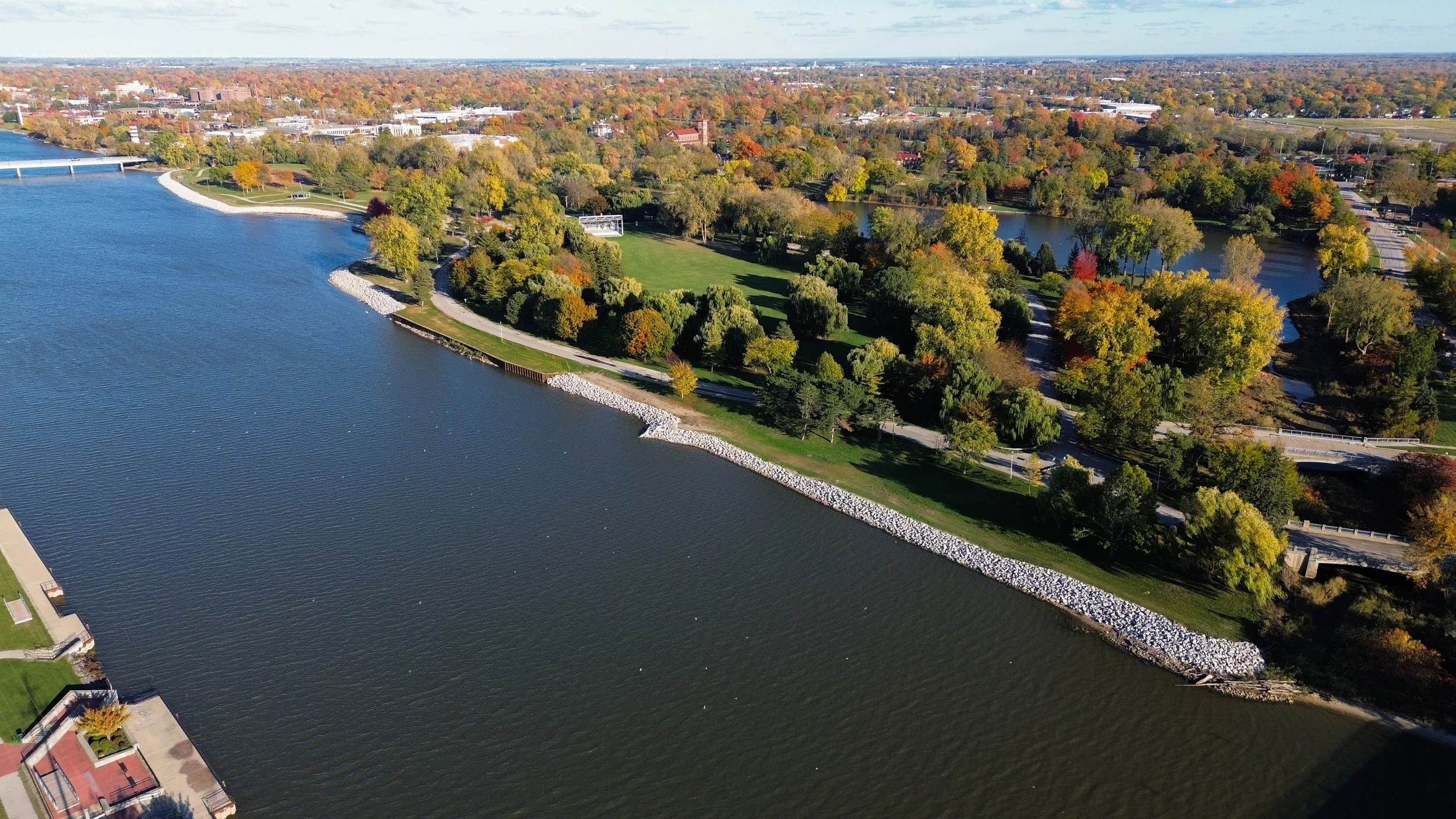
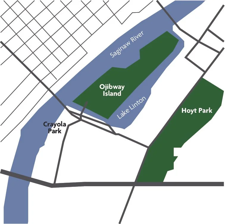
The City of Saginaw’s Ojibway Island and Crayola Park are not only central gathering places for the community, but also critical public assets along the banks of the Saginaw River. Over the years, fluctuating river levels, seasonal flooding, and wave action have eroded portions of the shoreline, threatening both public safety and the long-term stability of these popular recreation areas.
To address these concerns, the City of Saginaw partnered with Spicer Group, Merjent, and StreamsideEco to develop and implement a comprehensive shoreline stabilization plan. The project goal was aimed at repairing and protecting approximately 0.56 miles of eroded shoreline along Ojibway Island and an additional 295 feet at Crayola Park. This effort not only restored the structural integrity of the banks, but also protects the parks’ usability.
Spicer Group’s involvement began with gathering the precise data necessary to design effective stabilization measures. We deployed advanced Mobile LiDAR technology to create a detailed three-dimensional model of the project area. This allowed the team to quickly and accurately capture topographic information along the shoreline, even in areas with limited accessibility.
Accompanying the LiDAR survey, Spicer Group also conducted a bathymetric survey of the Saginaw River shoreline. This underwater mapping provided insight into the depth and condition of the riverbed adjacent to the eroded banks. By combining the LiDAR and bathymetric data, the engineering team was able to develop a complete picture of the site’s existing conditions, both above and below the waterline.
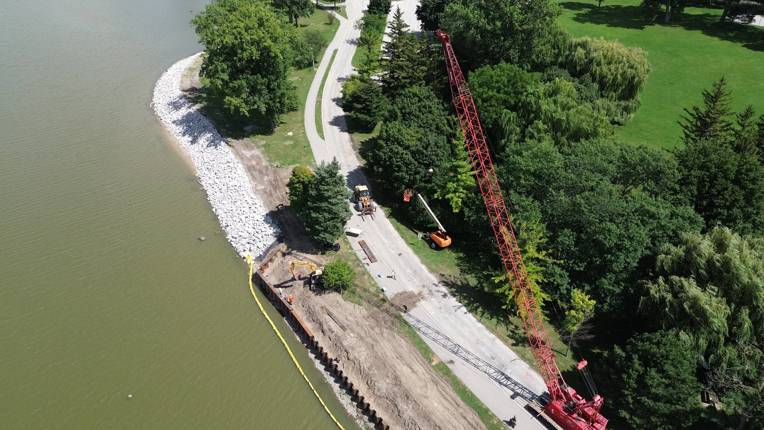
With the detailed survey data, Spicer Group moved into the design phase of the project. Our team developed plans that addressed both the immediate erosion concerns and the sustainability of the shoreline for the future. The designs incorporated stabilization methods tailored to the site’s conditions, including the installation of heavy riprap and steel sheet piling in targeted areas.
The designs also accounted for existing drainage patterns and sought to produce a stable shoreline that seamlessly blended into adjacent topography. The intent was for the completed project to provide a stable shoreline that included many of the existing meanders. By including soil erosion and sedimentation control (SESC) measures in the design, Spicer Group ensured that the project would meet regulatory requirements while minimizing environmental impacts during construction.
Part of the design challenge involved working within areas where previous erosion control efforts, such as gabion basket riprap, had failed. These older systems had deteriorated over time, allowing waves and ice movement to further damage the shoreline. Spicer Group’s updated design replaced these systems with more durable materials and techniques, extending the life of the shoreline protection.

While Spicer Group led in providing the engineering and survey services, the project also required specialized environmental expertise provided by Merjent and StreamsideEco. Merjent conducted a wetland delineation of the project area and performed a freshwater mussel survey in the river in October 2023, adjacent to the proposed work area. This survey identified several native mussel species within the project area, including the state-endangered Lilliput. The Michigan Department of Natural Resources (MDNR) required these mussels to be relocated before construction began. Spicer Group coordinated with StreamsideEco for mussel collection and relocation to ensure stabilization measures did not adversely impact the mussel population. Follow-up mussel monitoring was conducted in 2025 by StreamsideEco to document the condition of the relocated mussels.
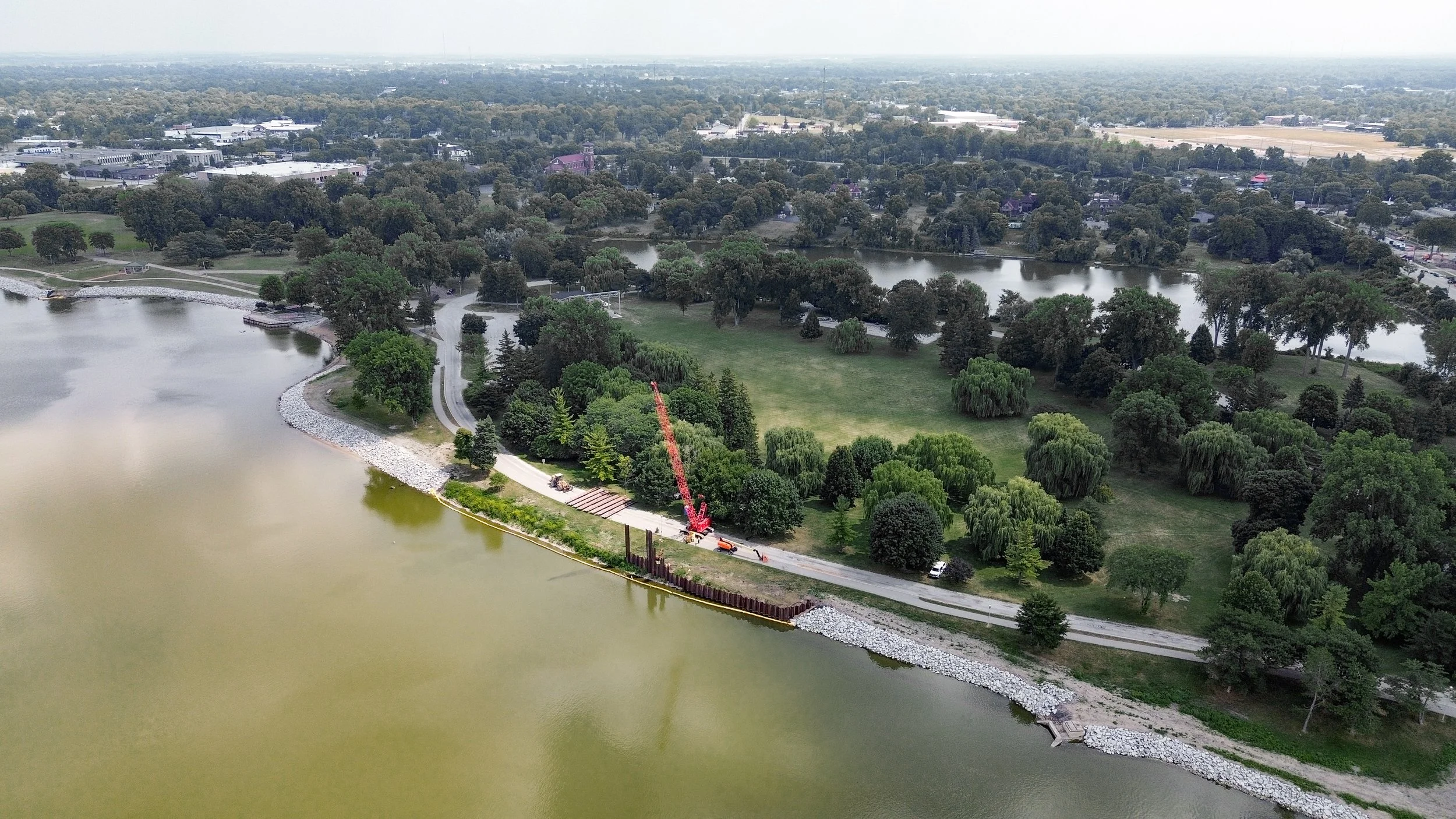
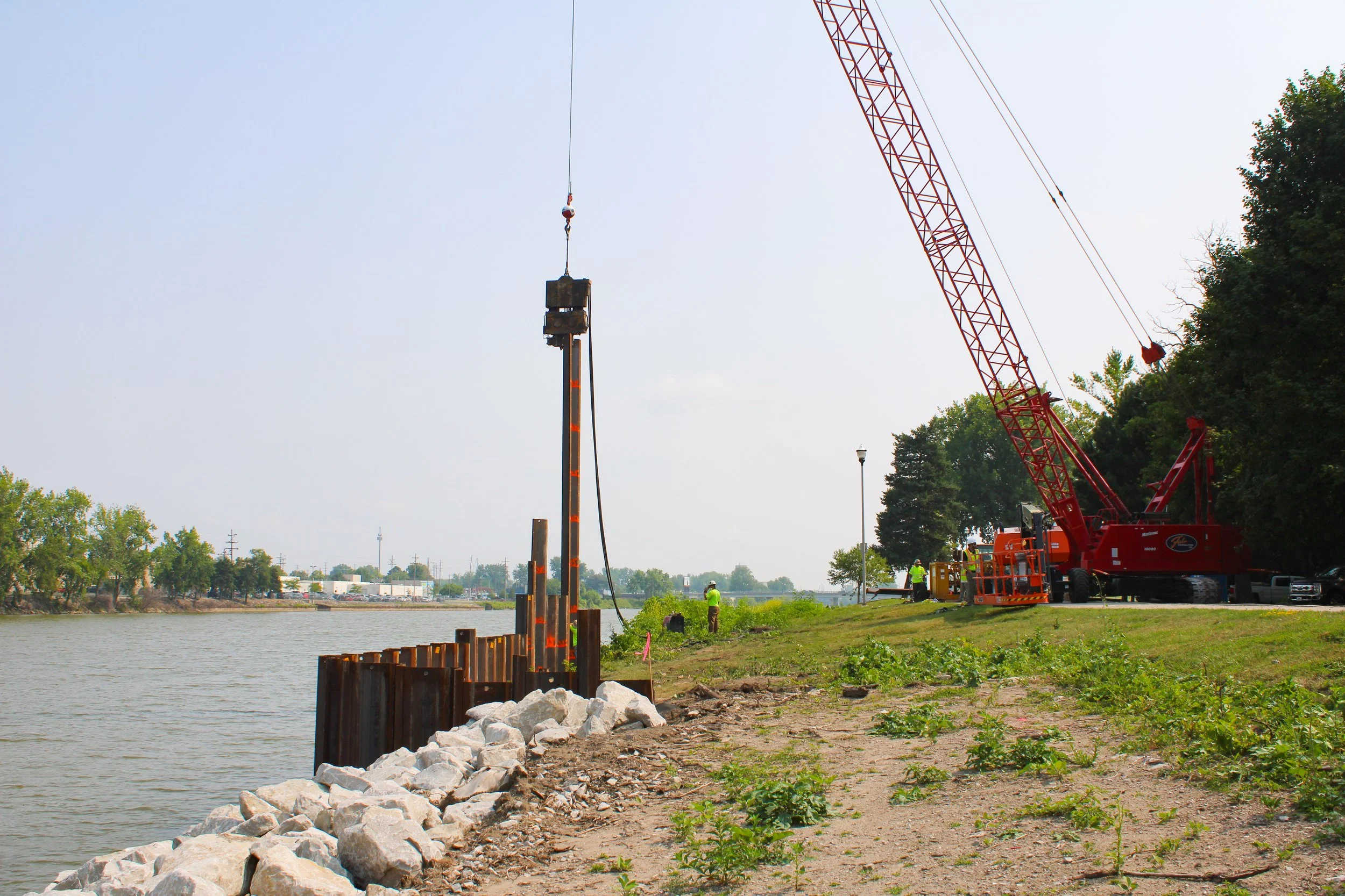
Once the design and permitting were completed, construction on the banks was able to begin in February 2025. Spicer Group’s role during this process included providing construction administration, inspection and bidding assistance.
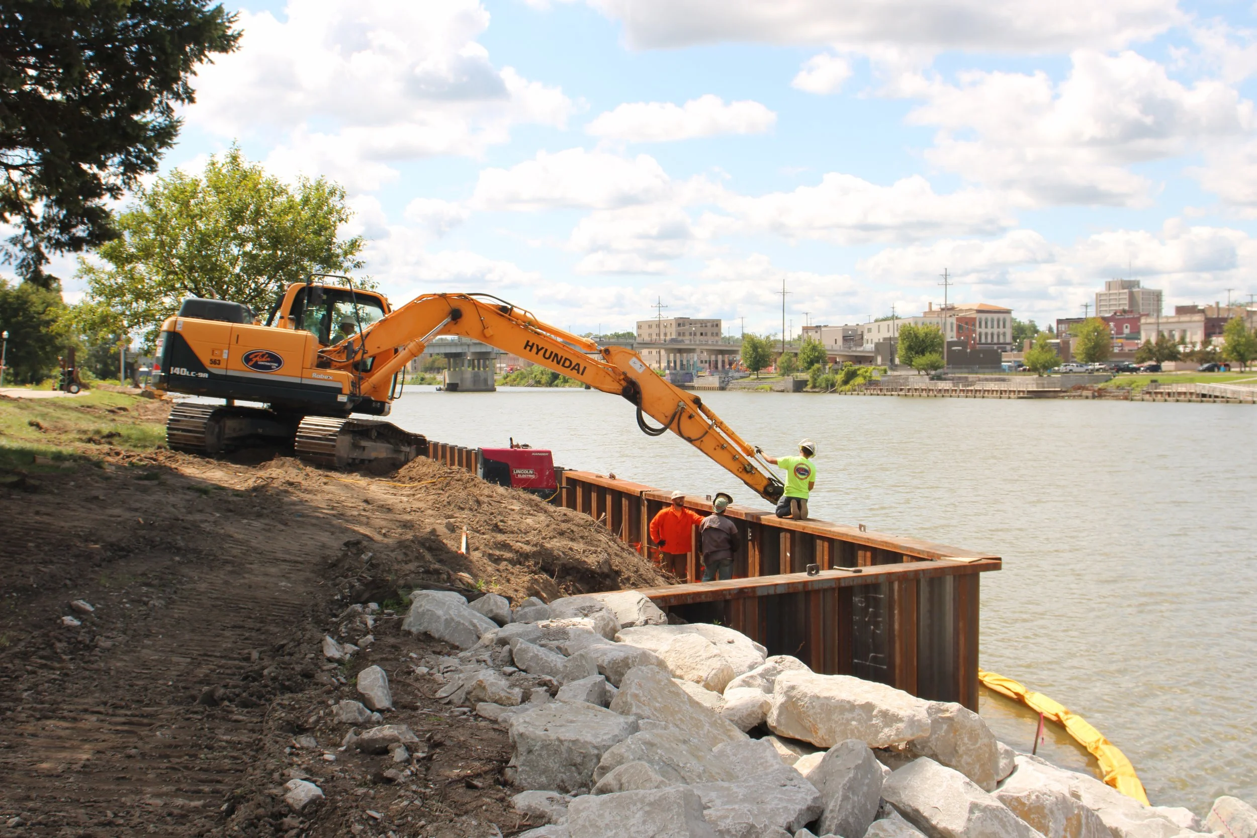
The construction work to stabilize the banks included a series of tasks including reshaping the eroded areas and installing protective barricades to prevent further material loss. Placing both plain and heavy riprap, along with steel sheeting, helps with shielding the banks from ongoing erosion. Unstable soils and vegetation that could compromise the new system were removed through targeted excavation and clearing. To safeguard water quality during construction, soil erosion and sedimentation control measures like silt fences and turbidity curtains were installed to prevent sediment from entering the Saginaw River. At Ojibway Island, stabilization efforts focused on the northwestern edge from the boat dock basin south to the pedestrian walkway, as well as the northernmost point of the island. At Crayola Park, work centered on the shoreline near the southern end of the park.
Although construction was ongoing, the team was able to coordinate with the contractor to have the Island stabilized to support 2025 City of Saginaw 4th of July celebration activities. Fourth of July fireworks are set off on the island with the main display setup being at the spoil leveling location. The contractor leveled the area with significant grass growth achieved prior to the fireworks display setup.
Additionally, riprap and stabilization measures were selected not only for their durability but also for their ability to blend into the surrounding landscape once vegetation regrows. This helps preserve the scenic value of the waterfront while protecting its stability.
The Ojibway Island and Crayola Park Bank Stabilization Project provides multiple long-term benefits to the City of Saginaw and its residents. The new stabilization measures protect public infrastructure, prevent further land loss, and reduce the risk of park closures due to unsafe shoreline conditions. Improved drainage and erosion control enhance the parks’ usability and reduce maintenance costs over time.