Davison Township GIS
Spicer Group worked with Davison Township to develop an Information Management System (IMS) to fit the custom needs of their Township. The Township’s IMS is comprised of three main components:
Relational Database Management System: The IMS has an SQL server environment as its data warehouse. The database system works to centralize data resources from within the municipality that include assessment data, spatial GIS data and other data resources.
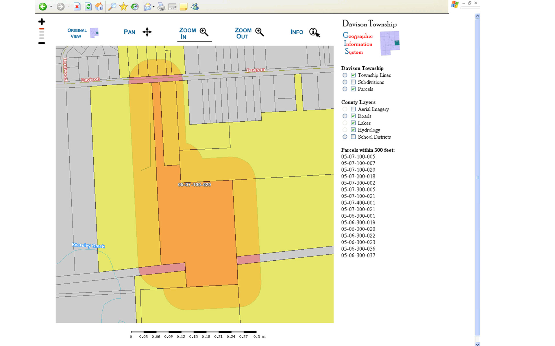
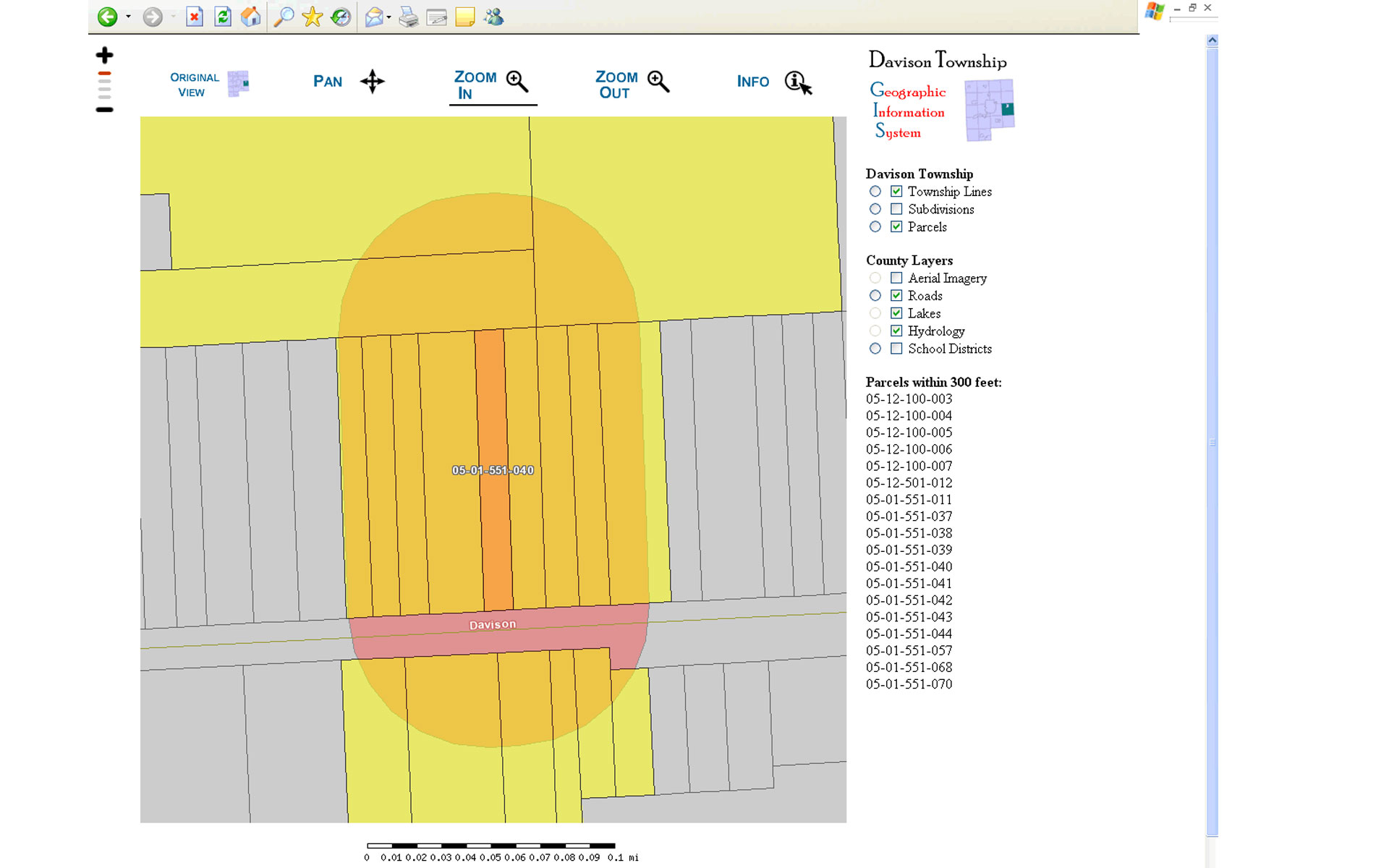
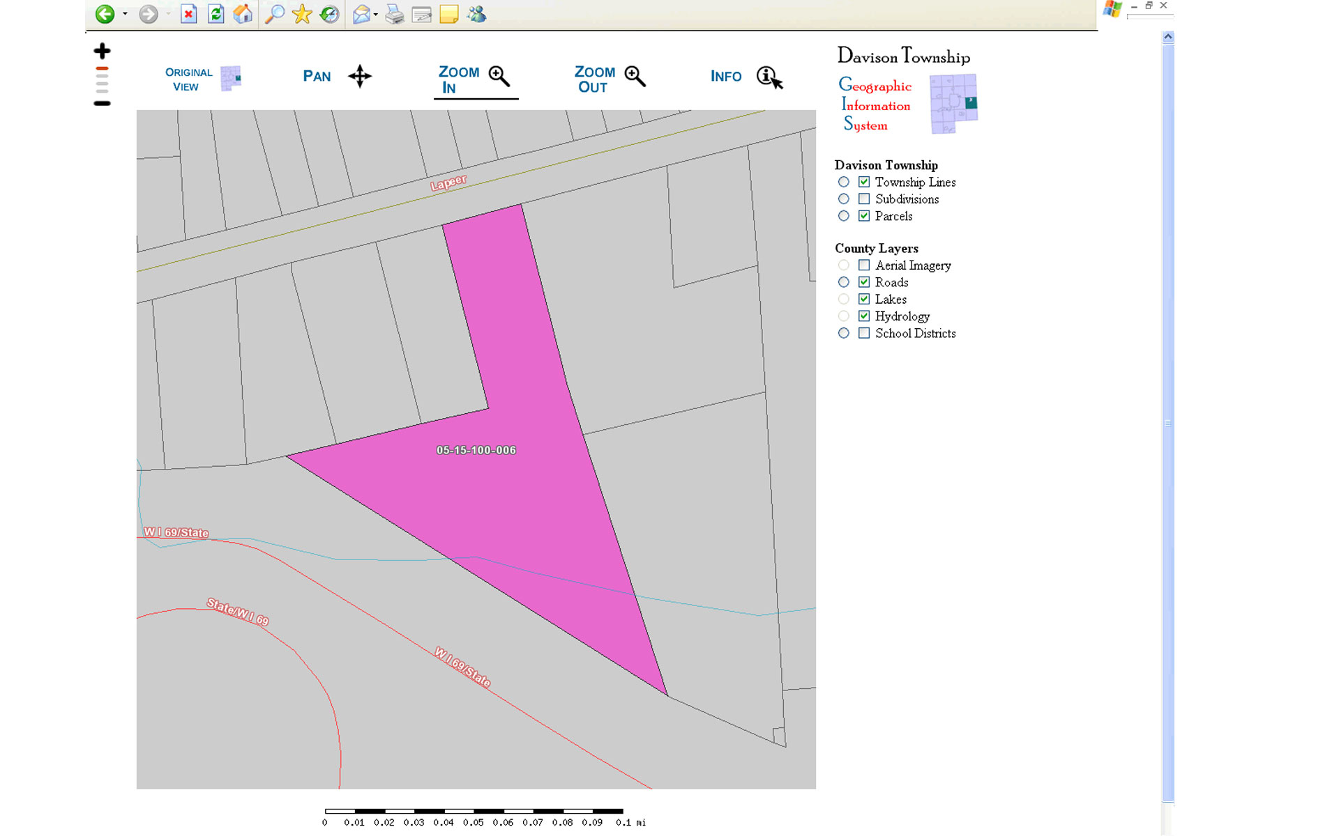
Geographic Information System: Spicer Group developed a GIS that is completely Web browser-based, utilizing standard ESRI shape files and open-source spatial database resources. The Township’s GIS includes: County Parcel Data; Integrated Assessment Data; a 300-foot parcel notification system; aerial imagery; and other GIS features.
Digitally Scanned Engineering Plans and Documents: Spicer Group assisted the Township in scanning their building, utility and site plans. These plans were then integrated into their IMS so they could be viewed easily and so the Township would have a digital backup for disaster recovering. Accessing a parcel within the Township’s IMS now provides quick access to scanning building, utility and site plans, 300-foot parcel notification system, assessment data integration and a detailed GIS solution.